Projects
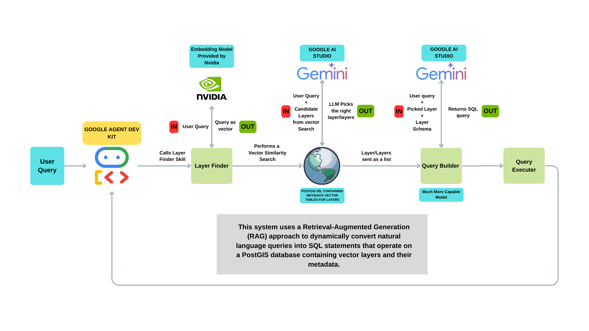
Retrieval-Augmented Spatial Query System with NVIDIA Embeddings and Google AI Studio
This architecture forms the foundation of my capstone project, which focuses on building an AI-powered spatial query system using fully open-source technologies. At its core, the system applies a Retrieval-Augmented Generation (RAG) pipeline that combines vector similarity search (powered by NVIDIA embeddings) with LLM-based SQL generation, targeting a PostGIS database of spatial layers and metadata. The project is currently in development, and future enhancements will include the integration of GeoServer to dynamically publish query results as WMS/WFS services, enabling rich map-based visualizations. It will also support automated generation of charts, graphs, and statistical summaries, providing a complete analytical interface for spatial data. In addition to system development, a key goal of the project is to benchmark multiple large language models (LLMs)—comparing latency, accuracy, token cost, and overall performance to identify the most effective models for spatial query interpretation and SQL generation. By leveraging a fully open-source stack, this project aims to deliver a transparent, extensible, and scalable solution for intelligent geospatial analysis.
View Project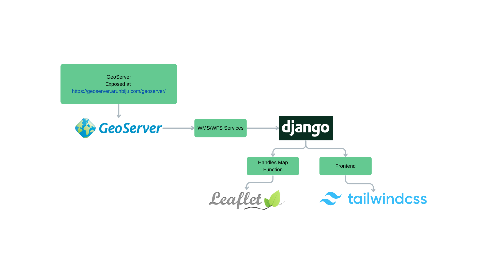
GeoServer Django Integration
This application features a lightweight approach to geospatial web development that efficiently combines several key technologies. GeoServer forms the backbone of spatial operations, managing all geospatial data and delivering standardized OGC services including WMS and WFS. Django handles the application flow and provides a robust framework for storing and managing layer metadata. On the frontend, Leaflet offers powerful client-side map rendering and interactive capabilities, while Tailwind CSS and Flowbite create a responsive and modern user interface. The application follows a clear separation of concerns in its geospatial workflow: GeoServer manages and exposes spatial data through standardized web services, Django stores and organizes metadata about GeoServer layers and workspaces, and the web interface uses Leaflet to communicate with GeoServer through WMS/WFS protocols. The system is designed for simplified deployment, with configuration files specifically optimized for Vercel hosting environments.
View Project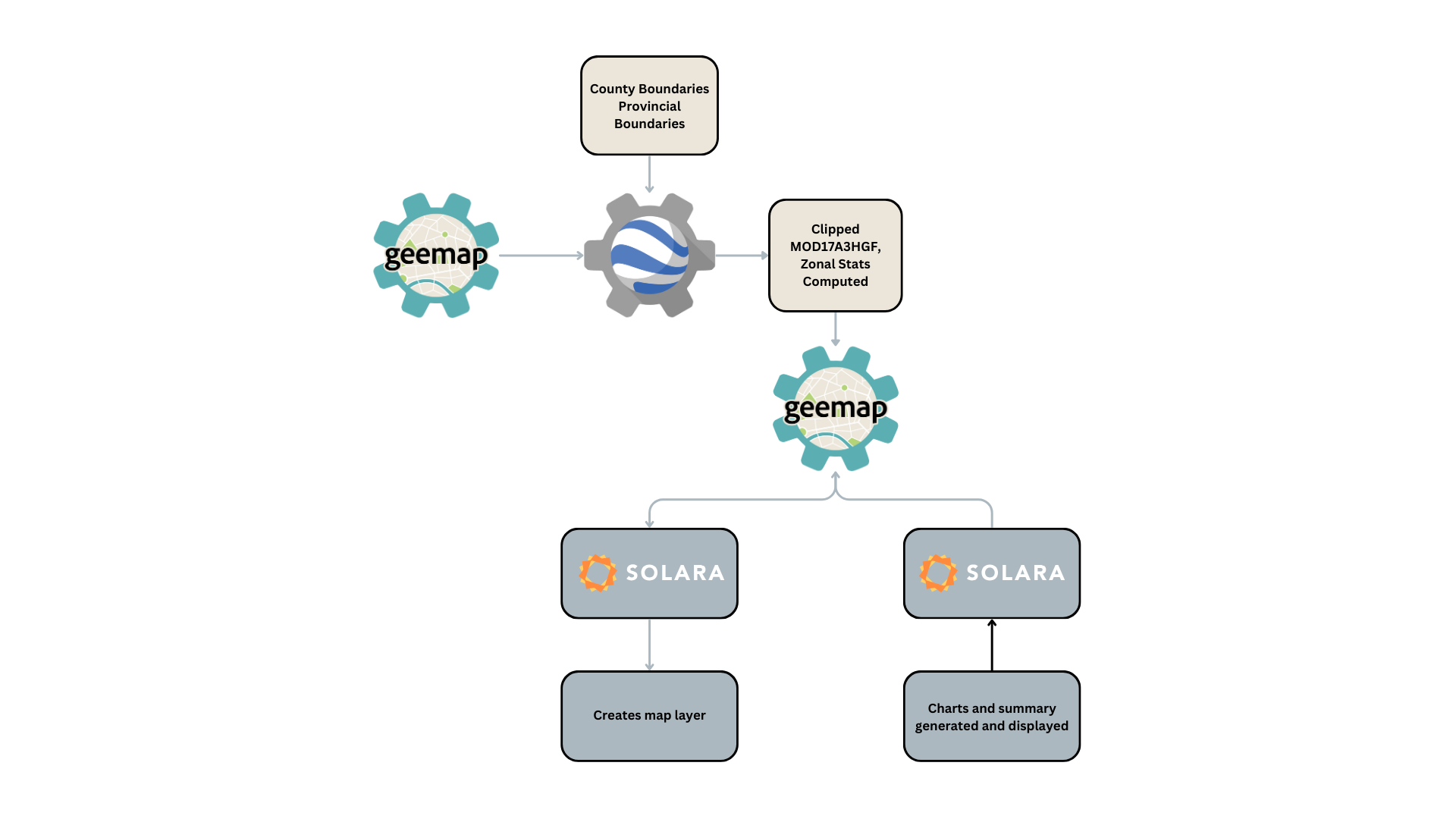
Earth Engine Web App for Nova Scotia's Vegetation Analysis
Earth Engine Web App for Nova Scotia – An interactive web application leveraging Google Earth Engine and Solara to analyze and visualize vegetation productivity in Nova Scotia using the MOD17A3HGF dataset. It provides dynamic maps and statistical insights for environmental monitoring and research.
View Project